|
 East
of Eden is a catchy way to describe the location of Melmerby, the starting
point for a breezy four hour walk. On the main road from Penrith to Alston
the village is at the foot of the Pennine escarpment, just a mile or so
east of the River Eden. Parking is no problem around the village green.
Start by heading south before turning off left on a road clearly aiming
towards the hills. Generally this unmetalled road keeps a steady ascent
to the final outbye gate and the rather offputtingly named 'Meikle Awfell'.
Then our route sweeps left to traverse up to the sheepfold on Blea Scar.
The ascent then becomes more gently threading through what the map worryingly
called sink holes. But these were long filled in features that must in
the distant past have pierced the gritstone. The views west from this
open moorland are wonderful on a clear day with all the Lakeland fells
being visible. The ascent to the top of Melmerby Fell is relatively featureless,
so this is perhaps not a place to explore in mist as a compass bearing
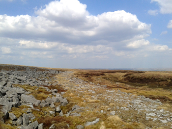
would be essential. Heading south our route comes upon the old Roman road,
named as Maiden Way on OS maps. This was perhaps the medieval nickname
for this route to the Roman base near Penrith. East
of Eden is a catchy way to describe the location of Melmerby, the starting
point for a breezy four hour walk. On the main road from Penrith to Alston
the village is at the foot of the Pennine escarpment, just a mile or so
east of the River Eden. Parking is no problem around the village green.
Start by heading south before turning off left on a road clearly aiming
towards the hills. Generally this unmetalled road keeps a steady ascent
to the final outbye gate and the rather offputtingly named 'Meikle Awfell'.
Then our route sweeps left to traverse up to the sheepfold on Blea Scar.
The ascent then becomes more gently threading through what the map worryingly
called sink holes. But these were long filled in features that must in
the distant past have pierced the gritstone. The views west from this
open moorland are wonderful on a clear day with all the Lakeland fells
being visible. The ascent to the top of Melmerby Fell is relatively featureless,
so this is perhaps not a place to explore in mist as a compass bearing
would be essential. Heading south our route comes upon the old Roman road,
named as Maiden Way on OS maps. This was perhaps the medieval nickname
for this route to the Roman base near Penrith.
Follow the faint route of this road as it descends westwards. After
a mile veer off to the right and pass between two hillocks and drop down
towards Fellside farm. The path keeps to the left alongside a stream valley
eventually opening the way to the metalled road at Row. Turn right and
common sense leads back north to Melmerby. After
a mile veer off to the right and pass between two hillocks and drop down
towards Fellside farm. The path keeps to the left alongside a stream valley
eventually opening the way to the metalled road at Row. Turn right and
common sense leads back north to Melmerby.
Other suggested walks:
Buttermere
Bow Tarn
High Street
Grasmere
Greengable
Whitbarrow
|

|


